One of the things I have most enjoyed about living in Suffield is the people who live here. My neighbors are always quick to lend a helping hand, whether it’s letting someone borrow a tool, helping haul brush to the dump or calling one another to get kids and pets indoors when a bear is spotted in the neighborhood. Beyond that, there’s a shared sense of courtesy. When someone is planning work near a property line, we check in with one another, consult, and make sure everyone is comfortable before moving forward. It reminds me of that old expression, “good fences make good neighbors.” But what happens when those fences—or more accurately, those boundaries—are not clear at all? That very situation played out here over 300 years ago, when the towns of Suffield, Windsor and Simsbury became entangled in a series of violent clashes I like to call the Suffield Border Wars.
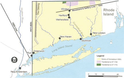
Before diving into the conflicts, it’s worth pausing for a geography lesson, because the New England map of the 17th and 18th centuries looked quite different than it does today. At the time, East Granby and Granby were part of Simsbury. Southwick belonged to Westfield. Windsor Locks was still part of Windsor. Agawam was tied to Springfield. And both Enfield and Suffield fell under Massachusetts jurisdiction, not Connecticut. The trouble had its roots in an errant survey conducted by the Massachusetts Bay Colony in 1642. That survey placed the border with the Connecticut Colony about seven miles farther south than Massachusetts’s charter actually allowed. Connecticut suspected the survey was faulty but, for over 50 years, did nothing to challenge it. Only in 1695 did Connecticut commission its own survey, and by then towns like Suffield, Simsbury and Westfield had already been established, their borders poorly defined by modern standards.
It helps to understand how imprecise surveying was at the time. Surveyors worked with chains, compasses and rough measurements that left plenty of room for error. On top of that, records were scattered, unindexed and often inaccessible. There was no centralized database to double- check boundaries. The result was inevitable: disputed frontiers that left residents unsure whose authority they lived under.
The first sparks flew in 1686, when Westfield and Suffield clashed over their western borders. The Massachusetts General Court ruled in favor of Westfield but attempted to compensate Suffield with land to its southwest. From Massachusetts’s perspective, that land was unclaimed. But residents of Simsbury and Windsor firmly believed the territory was theirs. To them, Suffield settlers were intruding, and they responded with hostility. Small militias were raised, patrols sent out, and violent encounters erupted. The colonial governments of Massachusetts and Connecticut eventually stepped in, urging calm with promises of future resolution. Yet the promised solution was slow to materialize.
By the 1690s, tensions rose again, this time between Suffield and Windsor. Windsor residents, aware of flaws in the original Massachusetts survey, began pressing their claims more aggressively. Massachusetts protested at first, even sending letters to Connecticut officials. But when those went unanswered, Massachusetts backed down, unwilling to risk reopening the broader question of whether towns like Suffield truly belonged to it.
The disputes did not stop there. By the early 1700s, the fight shifted to an unlikely but valuable resource: pine trees. These trees produced turpentine, essential for sealing wood used in ships, homes, and countless other applications. Ownership of pines meant economic advantage, and both sides wanted control. In 1703, Massachusetts attempted to halt the problem by passing a law forbidding turpentine tapping in Suffield until the boundary was resolved. The law proved ineffective. In 1704, Samuel Partridge of Hatfield wrote to Hartford on Massachusetts’s behalf, demanding the release of Suffield men arrested by Windsor residents for drilling pine trees in contested land. Arrests, skirmishes, and confrontations over these trees continued well into the next decade.
Finally, in 1713—after nearly 70 years of uncertainty – Massachusetts admitted that its 1642 survey had been wrong. A settlement was reached: Massachusetts would pay Connecticut for the towns of Suffield, Enfield, Somers and Woodstock, which would remain under Massachusetts’s jurisdiction. In return, Connecticut gained control of the land north of the faulty survey line. With that agreement, the Suffield Border Wars came to an end, and the long-disputed boundaries were finally settled.